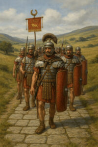

When Agricola pushed beyond Hadrian’s future frontier in AD 79, he faced bigger challenges than Pictish spears: boggy uplands, thick forest and 400 km of empty map between legionary supply depots. Rome’s solution was the thing it always trusted most—a road. The imperial engineers extended the already famous Watling Street (Dover → Londinium → Wroxeter) north-west to Chester, then swung it almost due-north as a fresh trunk artery that modern scholars call Dere Street. Whether you prefer the older Anglo-Saxon name “Wæclinga Stræt” or the academic tag “RR 8”, the brief was simple: a direct, all-weather corridor linking York to the fort-and-harbour complex at Inveresk on the Firth of Forth. Food, pay chests, dispatch riders—and, crucially, reinforcements—could now cover that distance in ten hard days of marching instead of three anxious weeks by cart-track.
How to Build a Road That Lasts Two Millennia
Roman surveyors used the groma to sight long alignments, then teams of legionaries and hired locals did the heavy lifting:
- Agger– A cambered embankment of earth and turf gave instant drainage.
- Statumen– Fist-sized stones were packed as a foundation.
- Rudus & Nucleus– Layers of gravel and clay, sometimes beaten with pila tampers, formed a concrete-like core.
- Summum dorsum– A paving of gravel, or in wealthy zones flat stone slabs, provided the final running surface.
- Margines & fossae– Turf kerbs and flanking ditches kept edges crisp and water away.
At Soutra in the Scottish Borders a 40 m slice shows the agger still two metres high. The Newbridge dig outside Edinburgh even found a log-raft base laid over a prehistoric watercourse—proof that Roman road-builders could improvise suspension bridges of oak brushwood when geology refused to cooperate.
The Route, Stage by Stage
Chester (Deva) to Carlisle (Luguvalium) followed the Dee valley, but the stretch we feel underfoot in Scotland begins when Dere/Watling crosses the Tweed near Jedburgh:
- Jedburgh → Trimontium (Melrose)– A straight climb over the Cheviots: look for the grass-crowned agger on the A68 verge.
- Trimontium → Soutra Hill– Here the road crests 370 m; on a clear day recruits glimpsed the silver Forth for the first time.
- Soutra → Vogrie → Sheriffhall– The line skirts Dalkeith; lidar surveys have revealed twin ditches flanking the agger through Midlothian farmland.
- Sheriffhall → Inveresk– The last 5 km is the best-preserved. Turf-walled “lane” Patten described in 1547 still guides the modern footpath to St Michael’s hill. Beneath Inveresk House a vaulted passage shows the same rammed gravel floor that once took cart-traffic straight into the fort’s south gate.
Onward traffic diverged: one spur dropped to the port at Fisherrow (the Auld Brig still sits on Roman oak sleeper beams), while another swung west toward Cramond and the Antonine Wall, delivering men and masonry for the short-lived northern frontier.
Why It Still Matters
Dere/Watling remained Scotland’s spinal road long after the eagles flew home. Medieval drovers drove cattle on it; Edward I marched to Falkirk along it in 1298; today stretches hide beneath the A1, A68 and even Edinburgh suburban lawns. Each excavation adds a footnote: in 2024 archaeologists under London’s Old Kent Road exposed a pristine length, its gravel capped by two chalk layers—textbook Roman road-craft visible like a layer-cake.
The discovery sent fresh eyes north, where ground-penetrating radar is now tracing the missing link across Dalkeith Country Park.
Why visit? Because standing on that cambered ridge at Soutra or walking the tree-lined lane into Inveresk you feel a direct line—physical, not metaphorical—connecting Dover’s White Cliffs to the Lothian coast. Few bits of infrastructure on earth can claim 1,900 years of more-or-less continuous service. Fewer still end at a Roman bathhouse floor you can touch under a Georgian garden. The next time your sat-nav starts barking directions on the A68, remember: it’s mostly following instructions first scratched on a tabula in AD 80.
Adapted From: Stirling, R. M’D. (1894). Inveresk parish lore: From pagan times. Musselburgh: T. C. Blair.